


Note: This is the second in a series of four posts about Iceland. The series begins here and continues here.
Now two days into our bold itinerary, you’re either exhausted and overwhelmed and wondering whether to simply fly from Vik to Akureyri and hunker down up there for a few days, or, having taken very seriously your hours allotted for sleep, you’re invigorated and eager to fjorge ahead toward more Icelandic wonders. This post assumes the latter. And so, continuing counterclockwise along Route 1, this next segment begins with Yoda and ends with puffins, with some mind-boggling terrain and tummy-delighting eats along the way.
DAY THREE, MORNING: A LIGHTHOUSE AND A JEDI
You’re starting this day down at 6 o’clock on the island, driving the coastline, and ending the day somewhere around 3 o’clock. This morning’s first activities will depend on whether you made it all the way to Vik last night or lodged somewhere west of town, as was our case – we glamped, as I mentioned, at the Farmhouse Lodge in Skeiðflötur, which was memorable but, despite the best efforts of our tent’s small space heater and several layers of blankets, not quite as toasty as we would have liked.
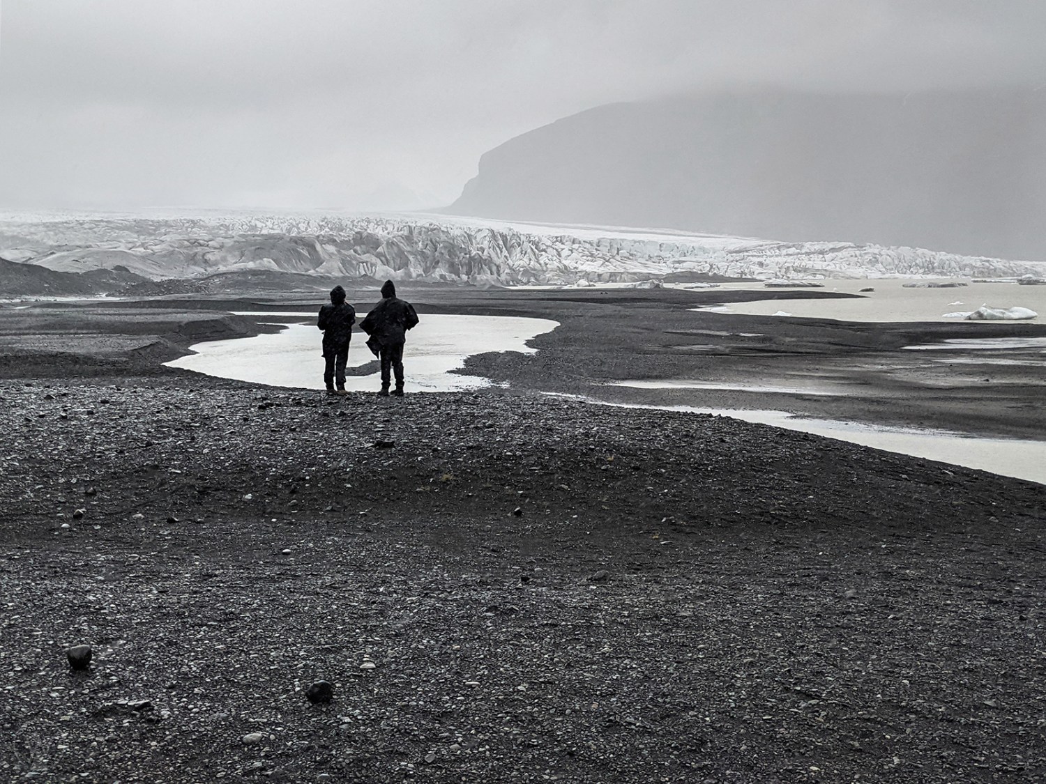
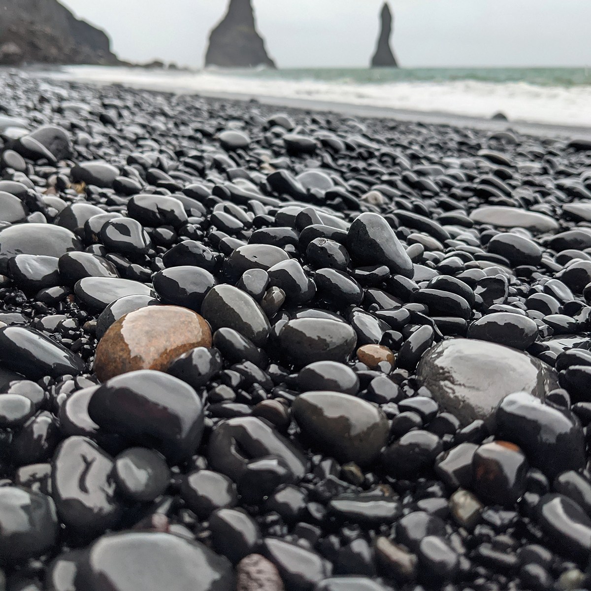
Overnighting west of Vik gives you the advantage of avoiding backtracking to visit some worthwhile sites that last night’s darkness likely ruled out. Ideally, you were able to see the Sólheimajökull glacier tongue just after Skógafoss, and so after breakfast you can seek out the views from the lighthouse atop Dyrhólaey peninsula (don’t bother with the lower lookout, instead going straight to the very top – and in the unlikely event you made it here last night for sunset, please share photos), and then go see the basalt columns at the east end of the Reynisfjara black sand beach. Be sure to walk all the way to Halsanefshellir cave, continuing beyond the primary outcropping where most visitors will gather then turn around.
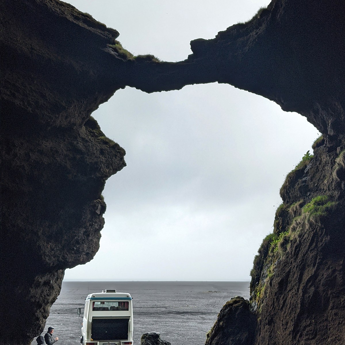
The town of Vik is itself not as charming as many you’ll visit later, but the big Icewear store is a good shop for woolen souvenirs, although there are higher quality handmade products all over the island. In this same complex is a serviceable café if you need a fast bite, but its limp pasta was one of just two disappointing dishes on our entire trip. Just east of Vik, at Hjörleifshöfði, is Gígjagjá, affectionately known as Yoda Cave. After turning right off of Route 1, continue toward the beach to the far south end of the mountain, and there will be no mistaking when you’ve found the right spot.
DAY THREE, AFTERNOON: BIEBS, GLACIAL TONGUES AND GRAVEL PITS
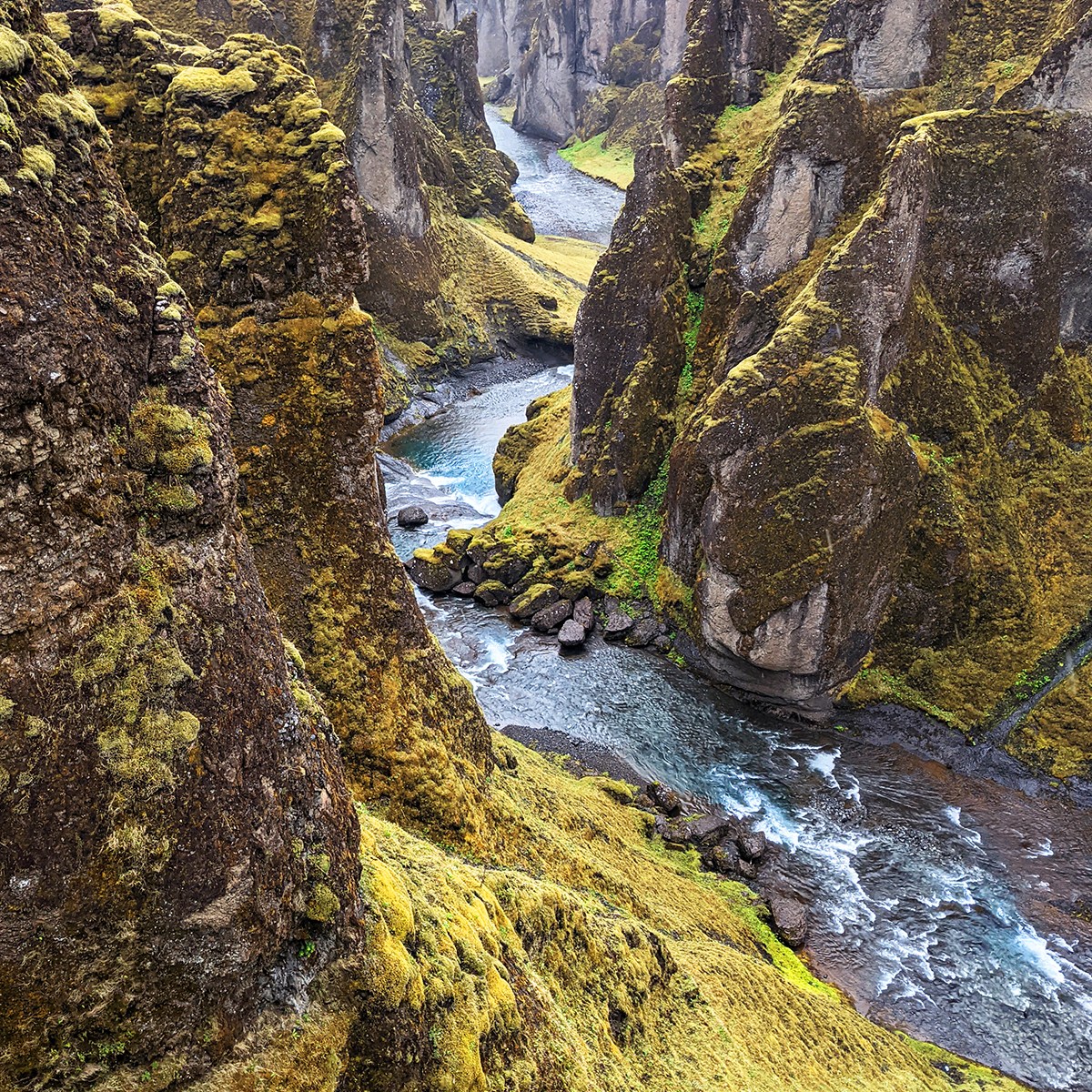
If you’re a Belieber, Fjaðrárgljúfur Canyon needs no introduction, because you’ll recognize it from the “I’ll Show You” video. In fact, in the years since JB himself was here, so many of your fellow fans have stampeded one of the more perilous spots where he stood, that authorities have constructed a walkway around it in order to reduce the risk of falls. (The general lack of walkways and handrails along this country’s many precipices hints at how concerning this instance was.) Now, to those of you who have no idea what any of this means: Visit Fjaðrárgljúfur. You’ll choose between two parking lots, the first of which places you closer toward the top of the canyon and will get you to the uppermost views more quickly, while the second one deposits you closer to the river as it exits the canyon, requiring a slightly longer hike than the upper lot but giving you lovely views along the way.
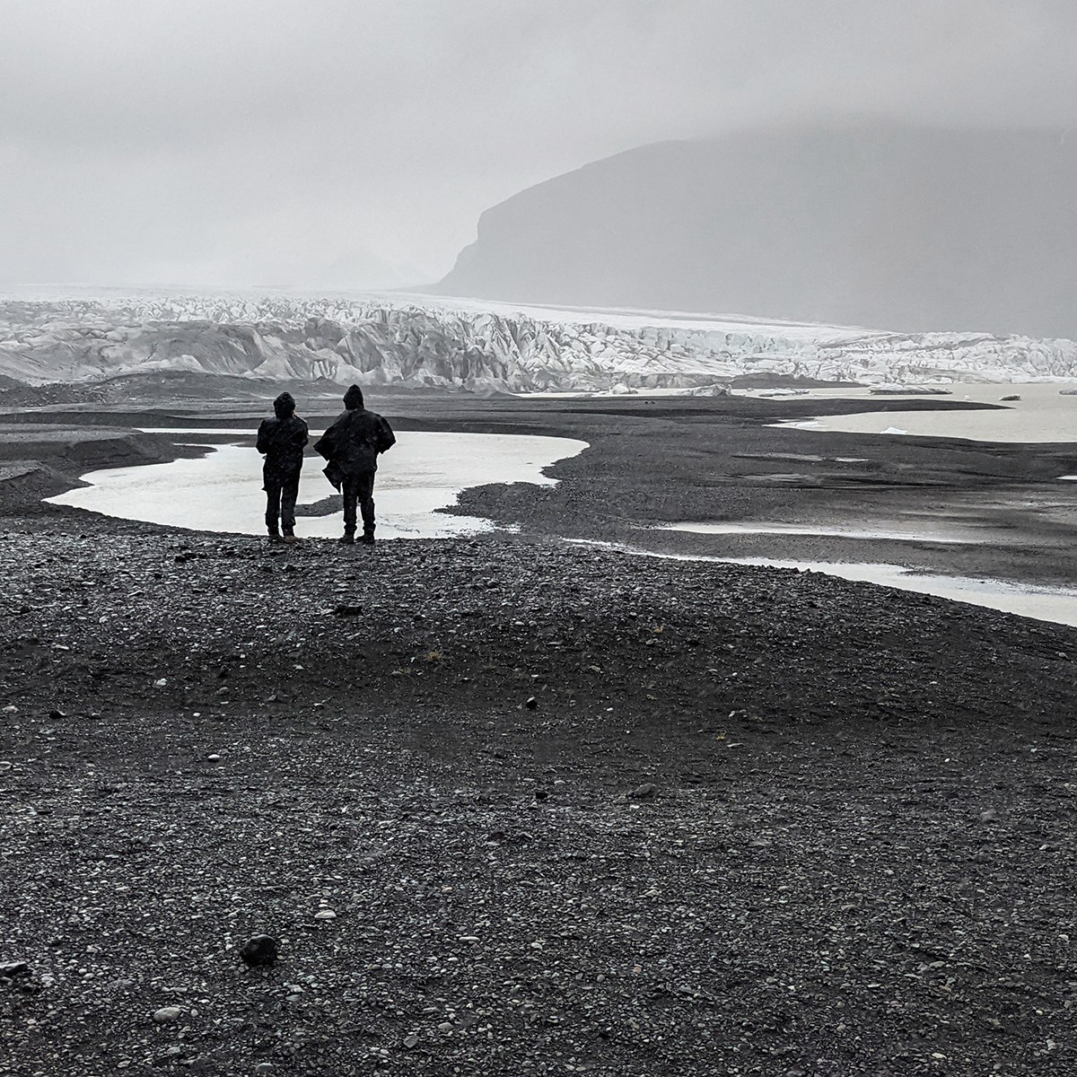
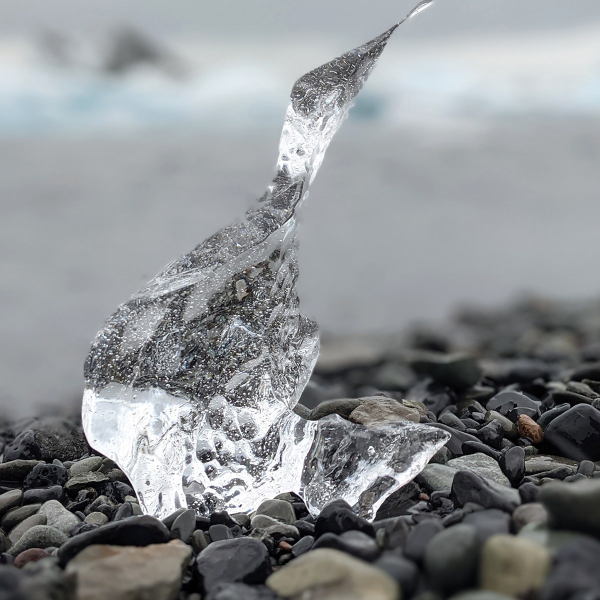
Next up are the Skaftifell glacier tongue and Svartifoss waterfall, as Route 1 starts to run close to the southern edge of Vatnajökull ice cap, Iceland’s largest, now becoming visible from the road. It was raining hard so we didn’t make it up to Skaftifell, plus the effusively solicitous (Have I mentioned that we only encountered one less-than-extremely-friendly person on our entire trip?) guides in the Vatnajökull National Park visitor center said the falls hike was a bit of a schlepp, but we did walk the easy, 20-minute trail eastward from the visitor center for a close and humbling view of the glacier tongue. Here and at any other glacial tongues you might visit, cast your glance downward on occasion to see fascinating sand erosion patterns in the meltwater.
Optional side excursion: Lightly-visited Múlagljúfur Canyon, a 4.3- kilometer out & back hike (or just 30 minutes along a moderate trail if you want to stop at the primary viewpoint) has been called one of the best hidden gems in all of Iceland, but the rain dissuaded us.
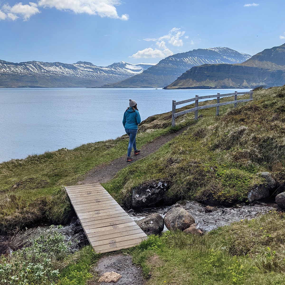
This section of the drive follows a topography unlike any you’re likely to experience elsewhere, as you cut across glacial deltas of pitch-black volcanic detritus. Within an hour beyond Skaftifell, this mesmerizing gravel pit at the end of the world is interrupted by two glacial lagoons full of icebergs, both of them just off the road. The first is Fjallsárlón, which some claim to be more interesting than the larger and more popular Jökulsárlón. We simply forgot (gasp!) to stop at Fjallsárlón and chose not to circle back, but Jökulsárlón was well worth a brief stop. On a more extended visit you can rent kayaks or take a boat tour, and there are sometimes seals present at Jökulsárlón. Sunrise and sunset are reportedly magical at both lagoons, when the light cuts horizontally through the icebergs as well as fanciful-shaped remnants strewn along the shore.
DAY THREE, EVENING: THE SOUTHEAST COAST
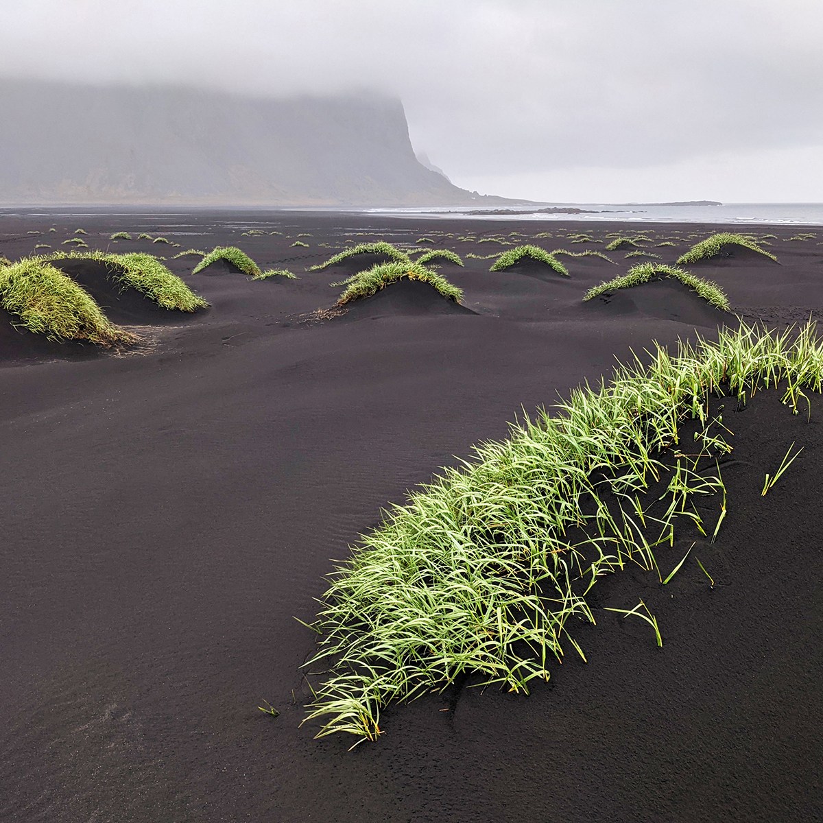
Continue past Hofn (no particularly compelling reason to see the town itself), head right off of Route 1 and down the Stokksnes peninsula, the turnout to which appears suddenly, just before you enter a tunnel. Because this is private property, you’ll pay a small fee at the little store, but three primary features make this well worth it: first, the view of the jagged Vestrahorn mountains toward the northeast; second, an extensive black-sand beach dotted with mini-dunes covered in tufts of grass that look like bad, green hair plugs; and third, the Hofn Air Station, which served as part of the North American early-warning radar network throughout the Cold War. Unless you want to hang out on the beach, this isn’t more than a half-hour detour from the main road.
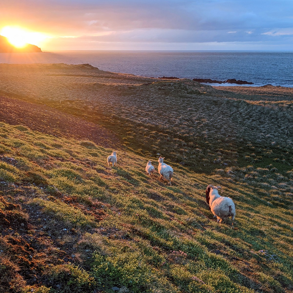
After Hofn, the road becomes very windy as the coastline transitions from mild bays into more angular fjords, and in some spots is an engineering wonder — meaning, you really wonder what’s keeping the entire mountainside from sliding onto your car. Watch for wild reindeer, which roam freely in this region. You won’t need to watch for the sheep, which are impossible to miss.
On the north bank of the Berufjörður, we ate a spectacularly simple dinner of split pea soup and fresh sun-dried tomato and walnut bread at the Havarí Farm dining room adjoining the Berunes Hostel, which sometimes has live music. The cook, Mariane, was a young lady from north of Paris, and our server was her Czech boyfriend, Jakob. They generously accommodated us after posted closing time, and treated us to a memorable dessert of yogurt mousse with rhubarb compote and crumbles.
We spent the night in Breiðdalsvík, which has a lively microbrewery, Beljandi Brugghús, but if you can make it even a bit farther up the coast, like to Fáskrúðsfjörður or Fjarðabyggð, that will be to your advantage in the morning. If by some miracle you can make it all the way to Egilsstaðir, all the better. As with any of the larger towns along Route 1, be vigilant of speed limit changes as you pull into Egilsstaðir, whose lögreglan (police officers) are very courteous and very alert.
DAY FOUR: PASSES AND PUFFINS
Spoiler alert: Odds are excellent that this will be one of the best days of your life, and at some point you’re almost certain to exclaim, “I can’t believe this place is just a six-hour flight from O’Hare!”
Depending on where you lodged, you might choose to start off with an optional side excursion to Neskaupstadur, a delightful fishing village accessed through a series of lengthy tunnels reminiscent of Norway’s west coast. Iceland’s easternmost town, Neskaupstadur blends serenity with vibrancy, as reflected, for example, in the rustic bait shop and restaurant run by the family of Haukon, one of Iceland’s most prominent drag queens. While the coastal trail to the Easter Cave was one of my favorite hikes of our trip – and great for kids – I’d consider Neskaupstadur a distant third priority to today’s two primary destinations.
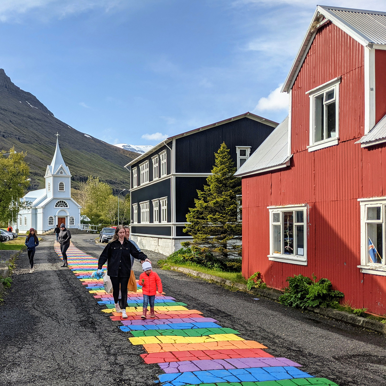
Seyðisfjörður has its charms, most of which, including a knitting shop that would make grandma squeal, are concentrated along Regnboga Vegur, the little rainbow street that runs to Seyðisfjarðarkirkja, the blue church. But don’t expect jaw-dropping, Lofoten-type awe. The reason why Seyðisfjörður is an absolute must is because of the drive over from Egilsstaðir on 93. It’s some of the most scenic terrain you’ll traverse today, which is really saying something.
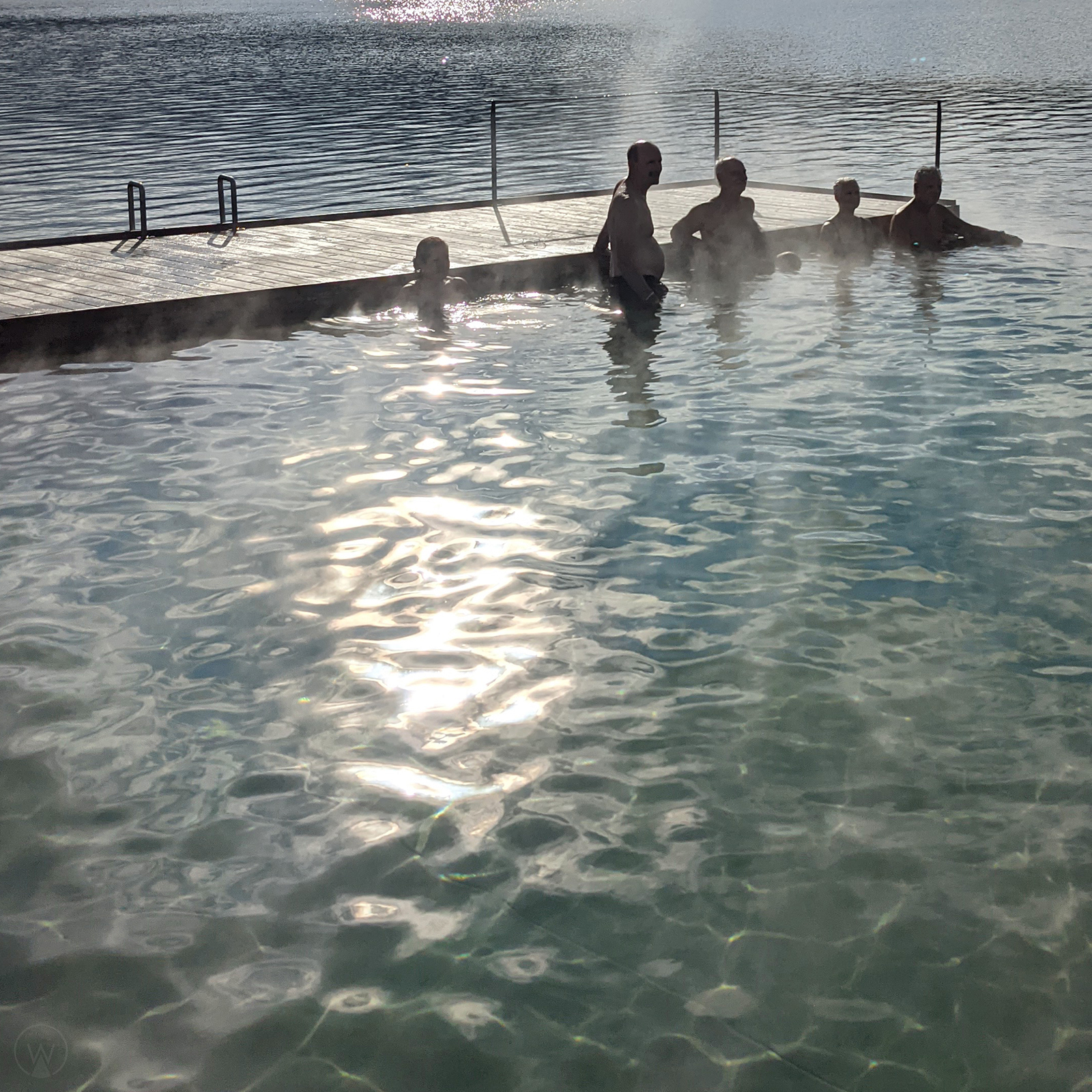
Before or after your drive to Seyðisfjörður, consider a dip in the Vök thermal baths just outside of Egilsstaðir. What they lack in the size or blueness of the Blue Lagoon they make up for in the mellow vibe of their almost exclusively local clientele, who taught us how to preserve body temp when dipping into the icy adjoining fjord. (It’s by keeping your wrists and the nape of your neck above water.) The café serves an excellent fare, convenient for brunch or lunch. That said, if timing is tight, you’ll get another opportunity to soak sublimely tomorrow evening.
Optional side excursion: Inland southwest of Egilsstaðir are two noteworthy waterfalls, Henigfoss and Litlanesfoss, as well as the Egilsstaðir Wilderness Center. We skipped these because of time, and because a friend said that the Wilderness Center, while highly rated, is “boring.”
Continuing your detour from Route 1, head due north on 94 from Egilsstaðir, all the way to Bakkagerði. Along the way, near Borgarfjarðarvegur, watch to your left for the solar-powered Coke Sjalfsali, Iceland’s loneliest vending machine. After 94 turns east and you begin to work your way up the pass switchbacking through the Innra Hvannagil Nature Preserve, pull over occasionally to soak in what’s behind you: the coast stretching toward the northwest, and rivers snaking along the valley floor toward the southwest. You’ll descend this same road soon, but the dynamic quality of light could make that an entirely different experience, so enjoy both.
You’ll know you’ve arrived in Bakkagerði by the appearance of sod huts near the roadside, some of the brightest and best-preserved that we saw. This area is famous for its trails, so pause for a hike or continue through the hamlet to the little peninsula of Borgarfjörður Eystri, where, just beyond the boats moored in the small harbor, is Borgarfjarðarhöfn, a high-density housing project for puffins. If you’re here during nesting season (May through August), you’ll find hundreds, maybe thousands of the adorable little birds. Grab a snack here – at Hafnarhus Café, not the puffin colony – and then drive back over the pass on 94, now with the sunset ahead of you. Don’t go back to Egilsstaðir; instead, head southwest on 944 and 925, perhaps lodging at one of the many cabins or guesthouses sprinkled near the Jökulsá á Brú river as you approach Route 1.
Try to manage your time today so that you’re not forced to choose between Seyðisfjörður and Bakkagerði, thinking perhaps, “Well, they’re both coastal villages accessed by pretty drives, so we’ll just…” We’d entertained a similar thought but are so glad we went to both, as they proved to be twin highlights of a trip with a lot of highlights.
QUESTIONS FOR READERS
- What is one of your favorite coastal drives, in Iceland or elsewhere?
- What are some areas of the world that have made you feel as if you were visiting another planet?
- What are some other natural formations that resemble characters or objects from pop culture?
